
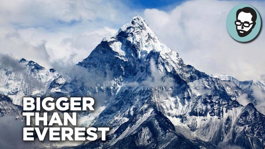
The Himalayas are by far the largest and tallest mountain range on Earth. Right now, anyway. As Earth’s continents have slammed into each other for billions of years, they have created supermountain ranges that put the Himalayas to shame. But were they taller? I look into in today’s video.
TRANSCRIPT:
Here’s a bombshell. Everest is not the name of the world’s tallest mountain. At least it’s not the name that mountain was supposed to have.
The guy Everest is named after is Sir George EEV-rist. Ol’ George held the post of Surveyor General during the Great Trigonometrical Survey of India, the longest direct land measurement taken prior to the twentieth century. The two thousand five hundred and five kilometer survey area included the peaks of the Himalayan Mountains, and the tallest peak was named in EEVrist’s honor.
The funny thing is, he actually opposed this step. He wanted the name of the mountain to be one used by locals. At the risk of inflaming the base, that’s pretty woke for a dude who died in the 1860s.
So what name was the mountain supposed to have? There are a few candidates, but the best attested is Chomolungma, a Tibetan name that means something like “Mother Goddess of the World”. Tibetan Buddhists celebrate Chomolungma as the home of Miyolangsangma, a beautiful monster-fighting woman who rides on tigerback and is, for some reason, orange.
I’m not sure where her orange skin came from. Must be good genes. The point is, Everest is only the mountain’s name [CLIP: ”From a certain point of view.”]
It happens that’s also true of the claim Everest is the tallest mountain on Earth. To understand why, we have to talk about what the word “tallest” actually means when applied to mountains. The natural answer may be that it’s the mountain that rises most from the base, but it happens there’s no scientific consensus on what the base of a mountain is.
Which is why other measurements are used, including the most popular, elevation above sea level. Measured by elevation, the Mother Goddess of the World is definitely the tallest at eight thousand eight hundred and forty-eight meters in height. But she does have kind of an unfair advantage.
See, Everest sits on the Tibetan Plateau. This plateau hosts the Himalayas, named in Sanskrit “abode of snow”. The fact that it snows half the year in a place that shares a latitude with Florida should clue you in that it’s pretty high.
Everest is a mountain sitting on a mountain, in other words, so the sea level thing really slants in its favor. To erase this advantage, some experts favor taking a common sense approach to measuring from base. The base-to-peak tallness of Everest is still impressive, but it’s not the most impressive out there.
In fact, there are at least four mountains on Earth that can be considered taller by base-to-peak measurement. One is above water. The other three are partly below water and the tallest of those is kind of a stretch.
Mind you, there are other ways to measure mountains that yield dozens of Everest beaters. That shouldn’t be a surprise, really. Definitions matter.
As much to illustrate that point as for any other reason, I thought it would be fun to talk about the world’s “tallest mountains” and compare them to others out there in the Solar System. If all that piques your interest, stick around. We’re about to elevate our knowledge up in here.
Any way you measure it, Sir George’s Chomolungma is a big girl. As I mentioned before, that’s partly because she stands on a tall base. As near as we can tell, the Himalayas formed between sixty and forty million years ago when India smacked into Asia on a northward trek.
These days, India is a part of the Asian continent. But sixty to forty million years ago, it was a free-floating island. Eighty million years before that, India was part of a supercontinent called Gondwana, which is unhelpfully named after a region in India.
The supercontinent Gondwana once included two-thirds of Earth’s current landmasses. India was there, wedged between Madagascar and Antarctica and kind of holding a hand to Australia. Then Earth’s tectonic plates shifted, and Gondwana broke up.
After the split, India drifted away from most of its neighbors. But it dragged Madagascar along, holding on to that former chunk of Africa for forty million years. Interestingly enough, you can see this in the fossil record.
The dinosaur species found in India are unlike the dinosaur species found anywhere in Asia, or nearby Europe for that matter. This makes sense since the dinosaurs died while India was still an island. Madagascan dinosaurs, on the other hand, are highly similar to Indian dinosaurs because they used to share an address.
Quick note here. There’s a non-zero chance that the extinction event that wiped out the non-avian dinosaurs happened in India. That may come as a surprise since the meteor strike that gets credit was in the Yucatan, but some geologists think the dust kicked up by the Chicxulub asteroid only added to ash from volcanoes that formed the Deccan Plateau.
Deccan means “south” and the modern plateau makes up most of India’s southern half. Circa sixty-six million ago, greenhouse gasses exploded from the ground there along with millions of tons of lava. This may have started a widespread climate change that Chicxulub only accelerated.
And remember, this all happened before India was part of Asia. It was an island, single and looking to mingle after the divorce from Madagascar.
So how did that happen? The answer is also volcanoes, but not the same ones. Underwater volcanoes in the Marion hotspot, around two thousand four hundred kilometers from where Madagascar is now, cracked it right off of India — how metal is that?
For something like twelve million years, India drifted alone with its dinosaurs. Then more volcanoes erupted, the dinos died and India went on up north. By the time it struck Asia sixteen million years later, it was moving at four point five centimeters per year, which is fast according to geologists.
What happened next gets complicated. But the short version is this. Whichever one of these blobs you want to call “India” shrank by 1000 kilometers after the impact.
I’m talking millions of years after impact because, again, it was moving at four point five centimeters per year. Some of India’s squashed mass sank, some rose, and the risen part is called the Himalayas. They took about forty-five million years to form and are still forming today because India is still moving north at four point five centimeters annually.
Now, there’s an important note here that is still contentious in the science. For the last hundred years the conventional thinking has been that India’s tectonic plate dove under the Eurasian tectonic plate. This doubled the thickness of the rock Everest sits on, which is how it was able to get so tall.
There are limits to how tall a mountain can be on Earth that are imposed by gravity and the composition of the planet. Earth’s crust is part of a rigid outer shell called the lithosphere. The lithosphere, in turn, rides over the asthenosphere, which is gooey and hot and occasionally throws magma at us.
You can only stack so much hard on the goo before it sinks. To see why, try putting a book on a mattress and a dog on the book. If your dog is too big, don’t try a cat, you’ll only get hurt.
Anyway, it turns out that the height limit of a mountain on Earth is around 10,000 meters. Any mountain that gets taller sinks into the underlying stone. Or it crumbles or the base spreads — there’s a lot that can happen and a lot that does.
To approach the maximum height potential, a mountain has to sit on thick crust. Everest’s crust is thick, but some scientists think it also has a layer of mantle sandwiched between that crust and the next slice of crust lower down. Mantle is harder than crust so it’s like having a hard cover on the book I sat Zoe on a minute ago.
Imagine Zoe on a paperback and you’ll see why this matters. Or you’ll see I’ve abused this metaphor. Look, all you need to know is India got squished.
Squish central is the Himalayas, which are still rising but can’t keep doing it forever. They’ll eventually stop due to compression but even after that, Everest is likely to remain the highest point on Earth by elevation.
There’s just not much higher a terrestrial mountain can go and Everest going there is kind of a fluke. So if that’s true, what’s this other measurements nonsense? I’m glad you asked.
To be clear, there’s no question that Everest is the tallest mountain on Earth by elevation. But if we measure from base to peak, exactly one mountain that sits above sea level is taller. That mountain is Alaska’s Mount McKinley, which happens to have the same sort of naming issues as Everest.
According to Alaska’s Indigenous peoples, the mountain’s name is Denali, meaning The Great One or The High One. That’s accurate, as even by elevation, Denali stands six-thousand-one-hundred-and-ninety meters above sea level. Granted, Everest’s eight-thousand eight-hundred forty-eight meters crushes it but remember, Everest is on a double-thick plateau.
If you measure from a sensible point on that plateau, Everest’s base-to-peak rise is only three-thousand-seven-hundred meters. Denali’s is five-thousand-five-hundred. …that’s more!
Again, defining a mountain’s base is tricky. We’re essentially saying that if you saw Everest and Denali side-by-side, Denali would look taller. Of course, that’s moving you to the mountain, not the mountain to you…oh, you get it!
For the record, climbers who’ve tried both tend to say Everest is harder. Anecdotally, this is not about elevation so much as features. The Khumbu Icefall and the Hillary Step are cited as examples of terrain that make surviving Everest a greater challenge.
But if you zoom out to the death statistics— Yeah. Elevation matters.
The vast majority of the three hundred-plus recorded deaths on Everest have been from eight thousand meters above sea level up. Altitude sickness is a major contributor to death. Which is why it takes weeks to train your lungs to cope with the decreased oxygen.
Climbers also have to train for Denali, of course. But, history records around one-hundred and thirty deaths there. …that’s less.
Clearly, sea level elevation vs base-to-peak height only tells part of a mountain’s story. Geology be crazy, and climbing a monster mountain is also nuts. Your mileage may vary but for my money, you’re much better off climbing another candidate for tallest terrestrial mountain.
This one. In Hawaii. In a car!
Hawaii’s Mauna Kea, short for Mauna a Wākea or White Mountain, is a base-to-peak beast.
But it’s super easy on the knees.
Measuring an astounding nine thousand nine hundred and sixty-six meters from the ocean floor, Mauna Kea can be summited in about an hour forty-five minutes, including a half-hour break to adjust to the air.
If you don’t have a four-wheel drive vehicle, you can summit Mauna Kea in four to six hours on foot. This beats the three weeks of a Denali summit and the six to ten weeks of an Everest expedition by a lot. The fact that Mauna Kea’s summit is only four thousand two hundred meters above sea level makes the trip easier.
But don’t skip the acclimatization time. People still die hiking Mauna Kea, just not so many. A healthy hiker can generally make it out with no worse than a headache.
By the way, Mauna Loa, the sister mountain to Mauna Kea, is also taller than Everest and Denali by base-to-peak measurement. It’s just not taller than Mauna Kea, so it’s not in contention for “tallest mountain” status. But Kea’s got Loa for drama, I’ll give her that.
Before we move on, there is one other watery tallest mountain contender I want to cover. Its claim on the title isn’t as strong, IMO, but that’s kind of the point. Definitions, remember?
Mount Lam Lam, on the island of Guam, peaks at four hundred six meters above sea level. It can be summited in half an hour, with no need for acclimatization. The reason I’m including it in this video is twofold.
First, because Lam Lam, like Mauna Kea and Mauna Loa, has a deep underwater base. And second— Well, I’m going to save second to the end, when we go off-planet.
Getting back to reason one, Guam is the southernmost of the Mariana Islands. The ocean floor slopes away from Guam in a gradual descent until it plunges into the Mariana Trench. The deepest point of the trench, Challenger Deep, bottoms out at ten thousand nine hundred and thirty-five meters below sea level.
In other words, a bowling ball rolled from the top of Lam Lam could travel a full kilometer more than one rolled from the top of Mauna Kea. That makes it the tallest, right? Well, maybe, but the thing is, the bowling ball would need help.
Lam Lam is part of a volcano that sits near the Mariana Trench, but not right on it. In fact, “near” is putting it strongly, as the distance from Lam Lam to Challenger Deep is over three hundred kilometers as the crow flies. So the vertical distance is extreme, but if we’re going out that far horizontally, it opens a can of worms.
I mean, if you add the twenty-six hundred meters of the Bay of Bengal to Everest’s height, you’d have a mountain that rises eleven thousand four hundred and forty-eight meters. That beats Mauna Loa and Lam Lam all the way to the Deep! The Bay of Bengal is a mere seven hundred kilometers from Everest, so it counts, right?
Sorry, I have to go back to Everest’s origin for a sec. It wasn’t always that far from the water, because the border of ancient India that got squished was once an ancient seabed. There are even seashell fossils at the top of Mount Everest, as you can see in the pics.
This means that the next time you want a vacation and you can’t decide between beach or mountain, you can have both! Provided you dress for the weather.
Alright, I think we can agree that calling Lam Lam the world’s tallest mountain stretches definitions a little too far. Don’t get me wrong, I’ve got nothing against the Guam tourist board. Love the hustle guys, but Lam Lam is out, unless it can challenge for tallest by some other measure.
Spoiler alert, it can’t, but by the measurement I’m about to mention, neither can Everest, Denali, or even Mauna Kea. This revolutionary measurement is checking the rise of the mountain from the center of our planet to peak. By that measurement, none of the mountains we’ve talked about so far are in the Top Ten tallest, or even the top twenty-five.
Earth is spherical, but it’s not a perfect sphere. Instead, it’s an oblate spheroid. That means round all over but thicker in the middle, like your mom.
There’s a formula to show how far the peak of any given mountain is from the center of the earth. I looked it up and OH GOOD GOD. Get that away and God bless user Klenke of summitpost-dot-org for making a form I can fill out.
With its help and some pre-calculated results I can tell you that of the mountains we’ve talked about, Everest is the tallest judged from earth’s center. I can also tell you that at least twenty-nine mountains are taller measured the same way. Denali, Mauna Kea, Mauna Loa, and Lam Lam all fall into the gutter.
The tallest mountain overall, it turns out, is Ecuador’s Mount Chimborazo. Chimborazo is a dormant volcano whose name means “Icethrone of God” or “snow over there” depending on who you ask. It’s an impressive mountain standing over six thousand two hundred meters above sea level.
Again, several mountains have higher elevations and several have taller base-to-peak measurements. But based on distance-to-center, Chimborazo’s six million three hundred eighty-four thousand four hundred and seventeen meters can’t be beat. And I think that’s the lesson of this comparison.
When it comes down to it, which mountain is tallest really depends on your point of view. A mountain climber is likely to care more about elevation than a planetary geographer and both will have issues with the Guam tourist board. In the end, there’s no tallest mountain on Earth, there’s only the tallest mountain to you.



Add comment